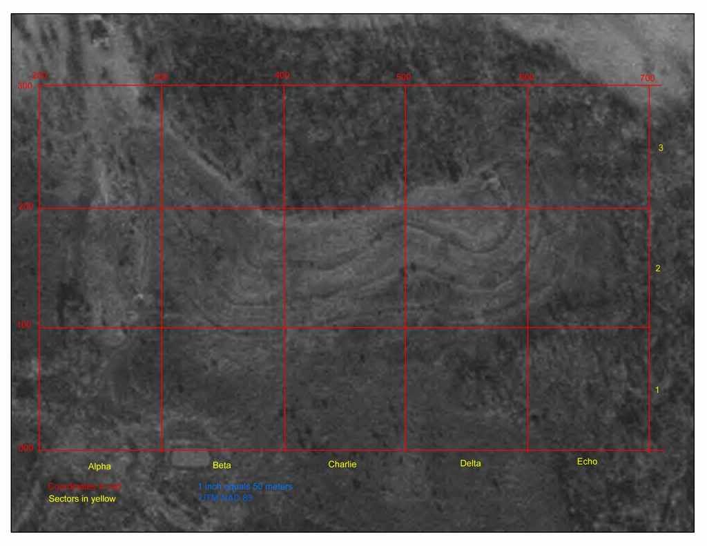
keep in mind...that was several years ago. the timber has been cut since then...so a lot of the HUGE old trees are gone...but much HEAVY small growth has taken its place. the clear looking areas are NOT clear...but rather grass, much of it tall and thick, with many smaller bushes. trails are even now being cut thru the grass, but it will not be cleared off (except around the installation/village sites,) so as to leave plenty of cover.
look at the map carefully, note the "start" of the trail area as marked. this is actually along a hilltop or top of a wide ridgeline. you can make out "other" ridgelines further down the map---as you go down in elevation...or "down" the incline of the hill. in between each ridgeline is a flat or semi-flat, field like area (now over grown with grass, trees, bushes, etc.) as you go down each ridgeline, you are going lower and lower....much like stepping stones. when you reach the complete BOTTOM of the stepping stone-like ridges...there is a swamp. we will NOT play there! lol!
back up at the top of the first or upper most ridge near the forest...where i have the village marked, is a sort of point. a cool place with a good overview of the land around it and pretty defendable.
in fact, all of the ridgelines are very defendable and will be tough to take.
here's the map/photo.

Beowolff